Satellite Imagery Map for Forest Protection
Source: Google AI Blogintermediate
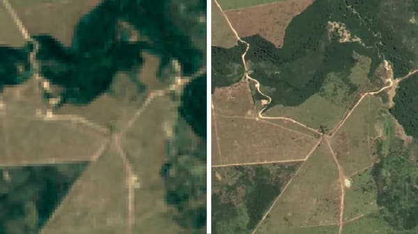
Google has partnered with the Brazilian government to create a satellite imagery map aimed at protecting Brazil's forests. This innovative tool leverages advanced satellite technology to monitor deforestation and promote conservation efforts. By providing real-time data, stakeholders can make informed decisions to safeguard these vital ecosystems. This initiative highlights the importance of technology in environmental protection and sustainable development.
Read the original → Google AI Blog
- #satellite
- #deforestation
- #environment
- #technology
- #conservation
Get five bites like this every day.
Tezvyn delivers a daily feed of 60-second tech bites with quizzes to lock in what you learn.